
Topografische Karte Dale
Interaktive Karte
Klicken Sie auf die Karte, um die Höhe anzuzeigen.
Über diese Karte
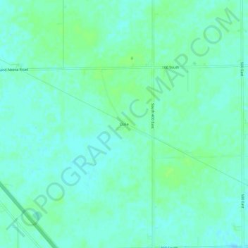
Name: Topografische Karte Dale, Höhe, Relief.
Ort: Dale, Boone County, Indiana, United States (39.99671 -86.42000 40.03671 -86.38000)
Durchschnittliche Höhe: 291 m
Minimale Höhe: 287 m
Maximale Höhe: 296 m
Andere topografische Karten
Klicken Sie auf eine Karte, um ihre Topografie, ihre Höhe und ihr Relief anzuzeigen.
Jamestown
United States > Indiana > Boone County
Jamestown, Boone County, Indiana, United States
Durchschnittliche Höhe: 292 m
Zionsville
United States > Indiana > Boone County
Zionsville, Boone County, Indiana, 46077, United States
Durchschnittliche Höhe: 273 m
Lebanon
United States > Indiana > Boone County
Lebanon, Boone County, Indiana, 46052, United States
Durchschnittliche Höhe: 287 m
Fayette
United States > Indiana > Boone County > Fayette
Fayette, Boone County, Indiana, United States
Durchschnittliche Höhe: 284 m
Jamestown
United States > Indiana > Boone County > Jamestown
Jamestown, Boone County, Indiana, United States
Durchschnittliche Höhe: 292 m