
Topografische Karte Artesia
Interaktive Karte
Klicken Sie auf die Karte, um die Höhe anzuzeigen.
Über diese Karte
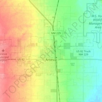
Name: Topografische Karte Artesia, Höhe, Relief.
Ort: Artesia, Eddy County, New Mexico, United States of America (32.81720 -104.48169 32.87881 -104.34774)
Durchschnittliche Höhe: 1.037 m
Minimale Höhe: 1.004 m
Maximale Höhe: 1.080 m
Artesia is located in northern Eddy County at 32°50′34″N 104°24′44″W / 32.84278°N 104.41222°W / 32.84278; -104.41222 (32.842744, -104.412315), at an elevation of 3,380 feet (1,030 m). US 82 leads east 64 miles (103 km) to Lovington and west 110 miles (180 km) to Alamogordo, while US 285 leads north 40 miles (64 km) to Roswell and south 36 miles (58 km) to Carlsbad, the Eddy County seat.