
Topografische Karte Toxibó
Klicken Sie auf die Karte, um die Höhe anzuzeigen.
Über diese Karte
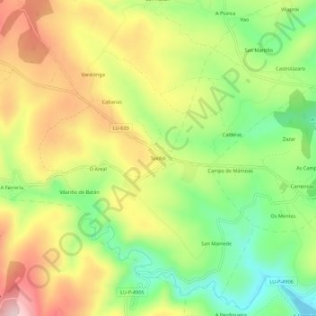
Name: Topografische Karte Toxibó, Höhe, Relief.
Ort: Toxibó, Gonzar, Portomarín, Lugo, Galicia, 27188, España (42.79284 -7.68470 42.83284 -7.64470)
Durchschnittliche Höhe: 476 m
Minimale Höhe: 332 m
Maximale Höhe: 640 m
Andere topografische Karten
Klicken Sie auf eine Karte, um ihre Topografie, ihre Höhe und ihr Relief anzuzeigen.