
Topografische Karte San Mateo
Klicken Sie auf die Karte, um die Höhe anzuzeigen.
San Mateo
The main source of the municipality's water supply are deep wells, pump wells (operated by Manila Water), open wells, springs and other ground water resources. Some of the elevated parts of the municipality are under watershed protected areas since the topography is characterized by rolling to mountainous terrain. From 0.65%, San Mateo's water sanitation reached 100% on 2006 through the operation of Manila Water.
Über diese Karte
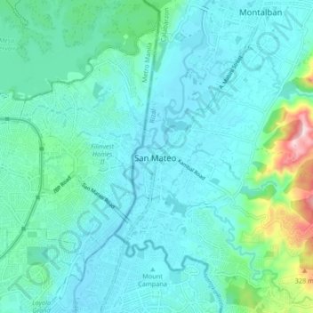
Name: Topografische Karte San Mateo, Höhe, Relief.
Ort: San Mateo, Rizal, Calabarzon, 1631, Philippines (14.65519 121.07740 14.73519 121.15740)
Durchschnittliche Höhe: 68 m
Minimale Höhe: 5 m
Maximale Höhe: 422 m