
Topografische Karte Tarahiki Island (Shag Island)
Interaktive Karte
Klicken Sie auf die Karte, um die Höhe anzuzeigen.
Über diese Karte
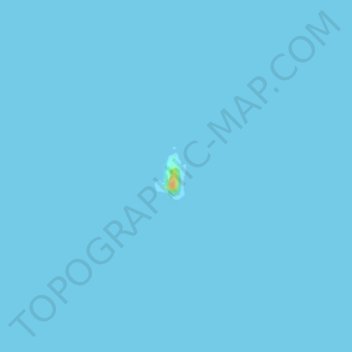
Name: Topografische Karte Tarahiki Island (Shag Island), Höhe, Relief.
Durchschnittliche Höhe: 0 m
Minimale Höhe: 0 m
Maximale Höhe: 30 m
Andere topografische Karten
Klicken Sie auf eine Karte, um ihre Topografie, ihre Höhe und ihr Relief anzuzeigen.
Waiheke Island
New Zealand > Auckland > Waiheke
Waiheke Island, Waiheke, Auckland, New Zealand
Durchschnittliche Höhe: 16 m
Days Bay
New Zealand > Auckland > Waiheke
Days Bay, Waiheke, Auckland, New Zealand
Durchschnittliche Höhe: 34 m
Hauraki Gulf
New Zealand > Auckland > Waiheke
Hauraki Gulf, Waiheke, Auckland, New Zealand
Durchschnittliche Höhe: 55 m
Rangitoto Island
New Zealand > Auckland > Waiheke
Rangitoto Island, Waiheke, Auckland, New Zealand
Durchschnittliche Höhe: 30 m
Motutapu Island
New Zealand > Auckland > Waiheke
Motutapu Island, Waiheke, Auckland, New Zealand
Durchschnittliche Höhe: 18 m
Rākino Island
New Zealand > Auckland > Waiheke
Rākino Island, Waiheke, Auckland, New Zealand
Durchschnittliche Höhe: 6 m
Rangitoto
New Zealand > Auckland > Waiheke
Rangitoto, Waiheke, Auckland, New Zealand
Durchschnittliche Höhe: 85 m
Pakatoa Island
New Zealand > Auckland > Waiheke
Pakatoa Island, Waiheke, Auckland, New Zealand
Durchschnittliche Höhe: 1 m
Motuihe Island
New Zealand > Auckland > Waiheke
Motuihe Island, Waiheke, Auckland, New Zealand
Durchschnittliche Höhe: 5 m
Ponui Island
New Zealand > Auckland > Waiheke
Ponui Island, Waiheke, Auckland, New Zealand
Durchschnittliche Höhe: 15 m
Rotoroa Island
New Zealand > Auckland > Waiheke
Rotoroa Island, Waiheke, Auckland, New Zealand
Durchschnittliche Höhe: 2 m
Waiheke Island
New Zealand > Auckland > Waiheke
Waiheke Island, Waiheke, Auckland, 1971, New Zealand
Durchschnittliche Höhe: 36 m