Geolokalisieren
👉 Easily get elevation data in JSON, GeoTIFF and KML formats using Elevation API
Vielen Dank für die Unterstützung dieser Website ❤️
Spenden

Topografische Karte Thorpe

Klicken Sie auf die Karte, um die Höhe anzuzeigen.

👉 Easily get elevation data in JSON, GeoTIFF and KML formats using Elevation API
Vielen Dank für die Unterstützung dieser Website ❤️
Spenden

Thorpe

Elevations are modest but not flat, ranging between 14 and 20m Ordnance Datum as much of the area lies on thin alluvium overlying gravel beds laid over millennia by the River Thames which adjoins the traditional parish to the east.

Wikipedia (CC-BY-SA 3.0)

👉 Easily get elevation data in JSON, GeoTIFF and KML formats using Elevation API
Vielen Dank für die Unterstützung dieser Website ❤️
Spenden

Über diese Karte

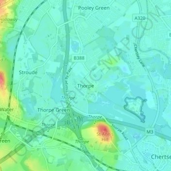
Name: Topografische Karte Thorpe, Höhe, Relief.

Ort: Thorpe, Borough of Runnymede, Surrey, England, TW20 8UE, United Kingdom (51.38891 -0.55296 51.42891 -0.51296)

Durchschnittliche Höhe: 19 m

Minimale Höhe: 8 m

Maximale Höhe: 71 m

👉 Easily get elevation data in JSON, GeoTIFF and KML formats using Elevation API
Vielen Dank für die Unterstützung dieser Website ❤️
Spenden