
Topografische Karte Naraingarh
Klicken Sie auf die Karte, um die Höhe anzuzeigen.
Naraingarh
Naraingarh is located near the foothills of the Sivalik range of the Himalayas in northwest India. It covers an area of approximately 481 km2. It shares its borders with the states of Himachal Pradesh. The exact cartographic co-ordinates of Narayangarh are 30°28′N 77°08′E / 30.47°N 77.13°E / 30.47; 77.13.It has an average elevation of 325 metres (1065 ft).
Über diese Karte
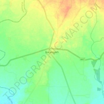
Name: Topografische Karte Naraingarh, Höhe, Relief.
Ort: Naraingarh, Ambala, Haryana, 134203, India (30.43239 77.08427 30.51239 77.16427)
Durchschnittliche Höhe: 321 m
Minimale Höhe: 305 m
Maximale Höhe: 342 m