Geolokalisieren
👉 Easily get elevation data in JSON, GeoTIFF and KML formats using Elevation API
Vielen Dank für die Unterstützung dieser Website ❤️
Spenden

Topografische Karte Colorado Springs

Klicken Sie auf die Karte, um die Höhe anzuzeigen.

👉 Easily get elevation data in JSON, GeoTIFF and KML formats using Elevation API
Vielen Dank für die Unterstützung dieser Website ❤️
Spenden

Über diese Karte

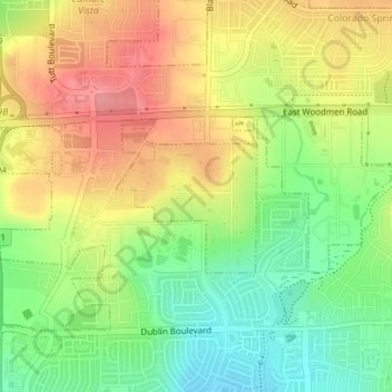
Name: Topografische Karte Colorado Springs, Höhe, Relief.

Ort: Colorado Springs, El Paso County, Colorado, United States (38.92997 -104.70923 38.94060 -104.69667)

Durchschnittliche Höhe: 2.097 m

Minimale Höhe: 2.051 m

Maximale Höhe: 2.143 m

👉 Easily get elevation data in JSON, GeoTIFF and KML formats using Elevation API
Vielen Dank für die Unterstützung dieser Website ❤️
Spenden

Andere topografische Karten

Klicken Sie auf eine Karte, um ihre Topografie, ihre Höhe und ihr Relief anzuzeigen.

Colorado Springs

United States > Colorado > El Paso County

Snowfall is usually moderate and remains on the ground briefly because of direct sun, with the city receiving 38 inches (97 cm) per season, although the mountains to the west often receive in excess of triple that amount; March is the snowiest month in the region, both by total accumulation and number of days…

Durchschnittliche Höhe: 2.229 m

Fountain

United States > Colorado > El Paso County

Durchschnittliche Höhe: 1.724 m

Stratton Meadows

United States > Colorado > El Paso County > Colorado Springs

Durchschnittliche Höhe: 1.819 m

Vielen Dank für die Unterstützung dieser Website ❤️
Spenden

Yoder

United States > Colorado > El Paso County

Durchschnittliche Höhe: 1.883 m

Gleneagle

United States > Colorado > El Paso County

Durchschnittliche Höhe: 2.099 m

Falcon

United States > Colorado > El Paso County > Falcon

Durchschnittliche Höhe: 2.111 m

Woodmoor

United States > Colorado > El Paso County

Durchschnittliche Höhe: 2.210 m

Vielen Dank für die Unterstützung dieser Website ❤️
Spenden

Stratmoor

United States > Colorado > El Paso County

Durchschnittliche Höhe: 1.780 m

Wigwam

United States > Colorado > El Paso County

Durchschnittliche Höhe: 1.605 m

Cascade

United States > Colorado > El Paso County

Durchschnittliche Höhe: 2.493 m

Security

United States > Colorado > El Paso County

Durchschnittliche Höhe: 1.769 m

Vielen Dank für die Unterstützung dieser Website ❤️
Spenden

Stratmoor Hills

United States > Colorado > El Paso County

Durchschnittliche Höhe: 1.799 m

Ben Lomand Mountain

United States > Colorado > El Paso County > Palmer Lake

Durchschnittliche Höhe: 2.220 m

Glen Park

United States > Colorado > El Paso County > Palmer Lake

Durchschnittliche Höhe: 2.321 m

Rocky Mountain

United States > Colorado > El Paso County

Durchschnittliche Höhe: 2.594 m

Vielen Dank für die Unterstützung dieser Website ❤️
Spenden

Palmer Lake

United States > Colorado > El Paso County > Palmer Lake

Durchschnittliche Höhe: 2.310 m

Cimarron Hills

United States > Colorado > El Paso County

Durchschnittliche Höhe: 1.949 m

Rush

United States > Colorado > El Paso County

Durchschnittliche Höhe: 1.835 m

Vielen Dank für die Unterstützung dieser Website ❤️
Spenden