
Topografische Karte Port Jefferson
Interaktive Karte
Klicken Sie auf die Karte, um die Höhe anzuzeigen.
Port Jefferson
It wasn't until 1836 that the local leadership truly initiated the community's transition from a swampish hamlet to a bustling port town. Twenty-two acres of the harborfront, which flooded with the tides, were brought to a stable elevation with the construction of a causeway. Concurrently, the village was rechristened from "Drowned Meadow" to "Port Jefferson" The name choice was in honor of Thomas Jefferson.
Über diese Karte
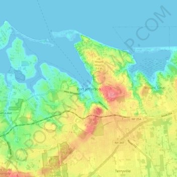
Name: Topografische Karte Port Jefferson, Höhe, Relief.
Durchschnittliche Höhe: 26 m
Minimale Höhe: -4 m
Maximale Höhe: 82 m