

Topografische Karte Blake
Klicken Sie auf die Karte, um die Höhe anzuzeigen.
Über diese Karte

Name: Topografische Karte Blake, Höhe, Relief.
Ort: Blake, Masterton District, Wellington, New Zealand (-40.84198 175.49092 -40.84188 175.49102)
Durchschnittliche Höhe: 568 m
Minimale Höhe: 308 m
Maximale Höhe: 910 m
Andere topografische Karten
Klicken Sie auf eine Karte, um ihre Topografie, ihre Höhe und ihr Relief anzuzeigen.


Spenmoor Street Reserve
New Zealand > Wellington > Wellington City > Wellington
Durchschnittliche Höhe: 151 m

Martinborough Community
New Zealand > Wellington > South Wairarapa District
Durchschnittliche Höhe: 141 m


Martinborough
New Zealand > Wellington > South Wairarapa District > Martinborough Community
Durchschnittliche Höhe: 34 m

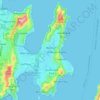
Miramar Peninsula
New Zealand > Wellington > Wellington City > Wellington
The peninsula is exposed to Wellington's prevailing northwest wind and the southerly wind. During southerly storms, big waves and swells batter the peninsula's rocky southern shore. The peninsula's topography, with its high ridges and small bays and coves, provides shelter from the wind in many places. On 15…
Durchschnittliche Höhe: 20 m