Topografische Karte Monda
Klicken Sie auf die Karte, um die Höhe anzuzeigen.
Monda
Monda is a town and municipality in the province of Málaga, part of the autonomous community of Andalusia in southern Spain. It is located near Sierra Blanca and Sierra de las Nieves in the comarca of Sierra de las Nieves. The municipality is situated approximately 44 kilometres from the provincial capital of Málaga and 10 from Coín. Monda has an altitude of 427 metres. It has a population of approximately 2,000 residents. The natives are called Mondeños.
Über diese Karte
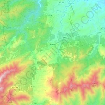
Name: Topografische Karte Monda, Höhe, Relief.
Ort: Monda, Sierra de las Nieves, Malaga, Andalusia, 29110, Spain (36.58444 -4.91695 36.66062 -4.79896)
Durchschnittliche Höhe: 506 m
Minimale Höhe: 126 m
Maximale Höhe: 1.187 m
Andere topografische Karten
Klicken Sie auf eine Karte, um ihre Topografie, ihre Höhe und ihr Relief anzuzeigen.