
Topografische Karte Champanagar
Klicken Sie auf die Karte, um die Höhe anzuzeigen.
Über diese Karte
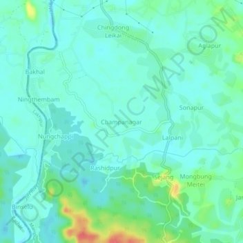
Name: Topografische Karte Champanagar, Höhe, Relief.
Ort: Champanagar, Jiribam district, Manipur, 795116, India (24.74814 93.09751 24.78814 93.13751)
Durchschnittliche Höhe: 37 m
Minimale Höhe: 23 m
Maximale Höhe: 84 m
Andere topografische Karten
Klicken Sie auf eine Karte, um ihre Topografie, ihre Höhe und ihr Relief anzuzeigen.
Senapati
Senapati District is located between 93.29° and 94.15° East Longitude and 24.37° and 25.37° North Latitude and is in the northern part of Manipur state. The District is bounded on the south by Kangpokpi District, on the east by Ukhrul district, on the west by Tamenglong district and on the north by Kohima…
Durchschnittliche Höhe: 1.454 m
Changangei Panchayat Tinpham Lampak
India > Manipur > Patsoi > Mayang Imphal
Durchschnittliche Höhe: 777 m
Thoubal
The district occupies the larger part of the eastern half of the Manipur Valley. The shape of the district is an irregular triangle with its base facing north. It lies between 23° 45' – 24° 45' North latitudes and 93° 45' – 94° 15' East longitudes. Its average elevation is about 790 m above the sea…
Durchschnittliche Höhe: 813 m