
Topografische Karte Tenkiller Ferry Lake
Interaktive Karte
Klicken Sie auf die Karte, um die Höhe anzuzeigen.
Über diese Karte
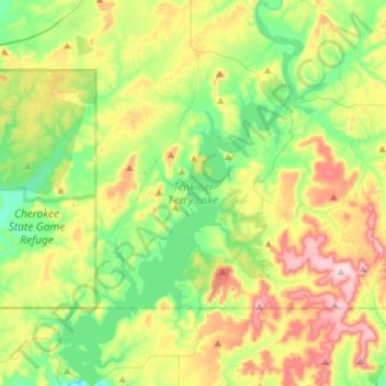
Name: Topografische Karte Tenkiller Ferry Lake, Höhe, Relief.
Durchschnittliche Höhe: 258 m
Minimale Höhe: 150 m
Maximale Höhe: 448 m
The hydroelectric power station is remotely controlled from the control center at Fort Gibson Lake. Two generators, each rated for 17 megawatts, provide a total capacity of 34 megawatts (MWe). The facility can handle 40 MWe for a short period of time. However, the amount of power that can actually be generated depends heavily on the lake elevation at any given time.