
Topografische Karte Lake Emily
Interaktive Karte
Klicken Sie auf die Karte, um die Höhe anzuzeigen.
Über diese Karte
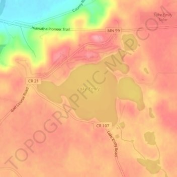
Name: Topografische Karte Lake Emily, Höhe, Relief.
Durchschnittliche Höhe: 296 m
Minimale Höhe: 225 m
Maximale Höhe: 325 m
Andere topografische Karten
Klicken Sie auf eine Karte, um ihre Topografie, ihre Höhe und ihr Relief anzuzeigen.
Saint Paul
USA > Minnesota > Saint Paul
Saint Paul, Ramsey County, Minnesota, USA
Durchschnittliche Höhe: 266 m
Forest Lake
USA > Minnesota > Forest Lake
Forest Lake, Washington County, Minnesota, 55025, USA
Durchschnittliche Höhe: 279 m
Hula Lake
USA > Minnesota > Silver Rapids
Hula Lake, Fernberg Trl; Fernberg Rd, Silver Rapids, Lake County, Minnesota, USA
Durchschnittliche Höhe: 411 m
Lake Marshall
Lake Marshall, Lockland Hills Drive, Lyon County, Minnesota, 56258, USA
Durchschnittliche Höhe: 353 m
Island Lake
USA > Minnesota > Island Lake
Island Lake, Beltrami County, Minnesota, USA
Durchschnittliche Höhe: 408 m
Lake Wilson
USA > Minnesota > Lake Wilson
Lake Wilson, Murray County, Minnesota, USA
Durchschnittliche Höhe: 507 m
Dark River
Dark River, Saint Louis County, Minnesota, USA
Durchschnittliche Höhe: 425 m
Keller Lake
Keller Lake, North Maplewood Drive, Maplewood, Ramsey County, Minnesota, 55109, USA
Durchschnittliche Höhe: 272 m
Johnson River
Johnson River, Saint Louis County, Minnesota, USA
Durchschnittliche Höhe: 382 m
Diamond Lake
USA > Minnesota > Minneapolis
Diamond Lake, Minneapolis, Hennepin County, Minnesota, USA
Durchschnittliche Höhe: 258 m
Bennett Lake
Bennett Lake, County Road C, Roseville, Ramsey County, Minnesota, 55113, USA
Durchschnittliche Höhe: 282 m
Kettle River
Kettle River, Carlton County, Minnesota, 55757, USA
Durchschnittliche Höhe: 367 m
Lake Henry
USA > Minnesota > Lake Henry
Lake Henry, Stearns County, Minnesota, USA
Durchschnittliche Höhe: 393 m