
Topografische Karte Pinyon Pines
Interaktive Karte
Klicken Sie auf die Karte, um die Höhe anzuzeigen.
Über diese Karte
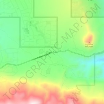
Name: Topografische Karte Pinyon Pines, Höhe, Relief.
Durchschnittliche Höhe: 1.276 m
Minimale Höhe: 1.040 m
Maximale Höhe: 1.621 m
It is located in a small valley between the San Jacinto Mountains and Santa Rosa Mountains, north of State Route 74. It takes its name from the Pinyon pine (Pinus monophylla) trees native to the area. Pinyon Pines sits at an elevation of approximately 4000 feet.