Geolokalisieren

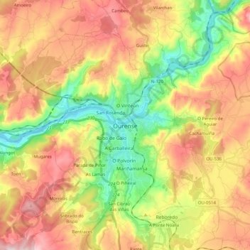
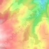
Topografische Karte Ourense

Klicken Sie auf die Karte, um die Höhe anzuzeigen.

Ourense

El relieve del municipio está definido por el valle que forma el paso del río Miño y sus afluentes Barbaña y Lonia, junto con las montañas que lo rodean. El río do Porto también desemboca en el Miño dentro del municipio, separando los Montes de Lodeiros, que superan los 350 m de altitud, de Monte Salgueiro y el Castro de Beiro, que superan los 450 m de altitud. La altitud del municipio oscila entre los 471 m al este (Montealegre) y los 90 m a orillas del río Miño, en el extremo occidental del municipio. La ciudad se alza a 139 m sobre el nivel del mar.

Wikipedia (CC-BY-SA 3.0)

Über diese Karte

Name: Topografische Karte Ourense, Höhe, Relief.

Ort: Ourense, Galicia, España (42.28951 -8.00350 42.39830 -7.80595)

Durchschnittliche Höhe: 322 m

Minimale Höhe: 87 m

Maximale Höhe: 581 m

Andere topografische Karten

Klicken Sie auf eine Karte, um ihre Topografie, ihre Höhe und ihr Relief anzuzeigen.
O Sobreiral

España > Galicia > Ourense > Ourense

Durchschnittliche Höhe: 273 m

Porto da Cima

España > Galicia > Ourense > Toén > Feá

Durchschnittliche Höhe: 171 m

Figueiras

España > Galicia > Ourense

Durchschnittliche Höhe: 382 m

O Cumial

España > Galicia > Ourense > San Cibrao das Viñas

Durchschnittliche Höhe: 283 m

Armental

España > Galicia > Ourense > A Peroxa

Durchschnittliche Höhe: 574 m

Covelas

España > Galicia > Ourense

Durchschnittliche Höhe: 416 m

Castiñeiras

España > Galicia > Ourense > Vilamarín

Durchschnittliche Höhe: 495 m

Outeiro

España > Galicia > Ourense > Vilarchao

Durchschnittliche Höhe: 250 m

Santa Mariña

España > Galicia > Ourense > Vilarchao

Durchschnittliche Höhe: 460 m

Taín

España > Galicia > Ourense > Vilarchao

Durchschnittliche Höhe: 405 m

Río do Grañal

España > Galicia > Ourense > Os Gozos

Durchschnittliche Höhe: 352 m

A Lonia de Abaixo

España > Galicia > Ourense > Ourense

Durchschnittliche Höhe: 208 m

Mende

España > Galicia > Ourense > Ourense

Durchschnittliche Höhe: 252 m

Vilar de Astrés

España > Galicia > Ourense > Ourense

Durchschnittliche Höhe: 305 m

Noalla

España > Galicia > Ourense

Durchschnittliche Höhe: 302 m

A Zamorana

España > Galicia > Ourense > San Cibrao das Viñas

Durchschnittliche Höhe: 345 m

Bentraces

España > Galicia > Ourense

Durchschnittliche Höhe: 359 m