
Topografische Karte Lake Hatchineha
Interaktive Karte
Klicken Sie auf die Karte, um die Höhe anzuzeigen.
Über diese Karte
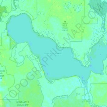
Name: Topografische Karte Lake Hatchineha, Höhe, Relief.
Ort: Lake Hatchineha, Osceola County, Florida, United States (27.98851 -81.46017 28.05919 -81.35388)
Durchschnittliche Höhe: 18 m
Minimale Höhe: 13 m
Maximale Höhe: 26 m
Andere topografische Karten
Klicken Sie auf eine Karte, um ihre Topografie, ihre Höhe und ihr Relief anzuzeigen.
Poinciana
United States > Florida > Osceola County
Poinciana, Osceola County, Florida, United States
Durchschnittliche Höhe: 24 m
Harmony
United States > Florida > Osceola County > Harmony
Harmony, Osceola County, Florida, United States
Durchschnittliche Höhe: 22 m
Yeehaw Junction
United States > Florida > Osceola County > Yeehaw Junction
Yeehaw Junction, Osceola County, Florida, United States
Durchschnittliche Höhe: 21 m
Twin Oaks Conservation Area
United States > Florida > Osceola County > Kissimmee
Twin Oaks Conservation Area, Kissimmee, Osceola County, Florida, 34744, United States
Durchschnittliche Höhe: 18 m
Saint Cloud
United States > Florida > Osceola County
Saint Cloud, Osceola County, Florida, United States
Durchschnittliche Höhe: 21 m
Kissimmee
United States > Florida > Osceola County
Kissimmee, Osceola County, Florida, United States
Durchschnittliche Höhe: 23 m