
Topografische Karte Ashford
Klicken Sie auf die Karte, um die Höhe anzuzeigen.
Über diese Karte
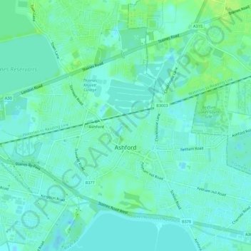
Name: Topografische Karte Ashford, Höhe, Relief.
Durchschnittliche Höhe: 16 m
Minimale Höhe: 11 m
Maximale Höhe: 23 m
Andere topografische Karten
Klicken Sie auf eine Karte, um ihre Topografie, ihre Höhe und ihr Relief anzuzeigen.
Staines-upon-Thames
United Kingdom > England > Surrey > Borough of Spelthorne
Much of the town is built on gravel "islands" that rise above the low-lying floodplains of the Thames and Colne. These gravel deposits have a typical maximum elevation of 14 m (46 ft) above ordnance datum (AOD) and are as little as 0.5 m (1.6 ft) above the surrounding floodplain. Staines High Street, oriented…
Durchschnittliche Höhe: 20 m
Pharaoh's Island
United Kingdom > England > Surrey > Borough of Spelthorne
Durchschnittliche Höhe: 14 m
Upper Halliford
United Kingdom > England > Surrey > Borough of Spelthorne
Based on 1841 census statistics, Samuel Lewis (publisher) in his 1848 A topographical guide to England stated the population of the parish of Sunbury which included Charlton and Upper Halliford, an area of 2,580 acres (1,040 ha) was 1,828.
Durchschnittliche Höhe: 13 m
Queen Mary Reservoir
United Kingdom > England > Surrey > Borough of Spelthorne > Charlton
Durchschnittliche Höhe: 14 m
Sunbury Court Island
United Kingdom > England > Surrey > Borough of Spelthorne
Durchschnittliche Höhe: 13 m