
Vielen Dank für die Unterstützung dieser Website ❤️
Spenden
Spenden
Topografische Karte Nanjanagudu
Klicken Sie auf die Karte, um die Höhe anzuzeigen.
Vielen Dank für die Unterstützung dieser Website ❤️
Spenden
Spenden
Nanjanagudu
Nanjangud is located at 15°07′N 76°41′E / 15.12°N 76.68°E / 15.12; 76.68. It has an average elevation of 657 metres (2155 ft). The taluk borders Mysore taluk of Mysore district to the north, T Narsipur taluk of Mysore district to the east, H D Kote taluk of Mysore district to the west and Gundlupet and Chamarajanagar taluks of Chamarajanagar district to the south.
Vielen Dank für die Unterstützung dieser Website ❤️
Spenden
Spenden
Über diese Karte
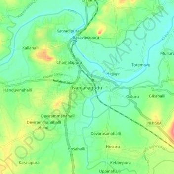
Name: Topografische Karte Nanjanagudu, Höhe, Relief.
Durchschnittliche Höhe: 667 m
Minimale Höhe: 641 m
Maximale Höhe: 725 m
Vielen Dank für die Unterstützung dieser Website ❤️
Spenden
Spenden