
Spenden
Topografische Karte Cuiabá
Klicken Sie auf die Karte, um die Höhe anzuzeigen.
Spenden
Cuiabá
The Massairo Okamura State Park provides a green space with typical cerrado vegetation in the centre of a highly urbanized area. It helps preserve the headwaters of the Barbado and Moinho streams. The 66 hectares (160 acres) Zé Bolo Flô State Park is in the Grande Coxipó district. The city also includes the 77 hectares (190 acres) Mãe Bonifácia State Park, created in 2000, also with typical cerrado trees. Cerrado includes various types of vegetation. It is characterized by extensive savanna formations crossed by gallery forests and stream valleys. Humid fields and "buriti" palm paths are found where the water table is near the surface. Alpine pastures occur at higher altitudes and mesophytic forests on more fertile soils.
Spenden
Über diese Karte
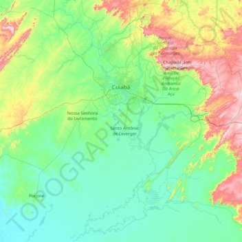
Name: Topografische Karte Cuiabá, Höhe, Relief.
Durchschnittliche Höhe: 259 m
Minimale Höhe: 110 m
Maximale Höhe: 901 m
Spenden