
Topografische Karte Dhupgarh
Interaktive Karte
Klicken Sie auf die Karte, um die Höhe anzuzeigen.
Dhupgarh
Mount Dhupgarh or Dhoopgarh is the highest point in the Mahadeo Hills (Satpura Range), Madhya Pradesh, India. Located in Pachmarhi in Hoshangabad district, it has an elevation of 1,352 metres (4,429 ft). The top of the hill is a popular area to watch sunsets. Pachmarhi Hill station is located close to the peak.[[1]
Über diese Karte
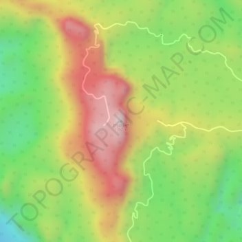
Name: Topografische Karte Dhupgarh, Höhe, Relief.
Ort: Dhupgarh, Pipariya Tahsil, Hoshangabad, Madhya Pradesh, India (22.44986 78.37372 22.44996 78.37382)
Durchschnittliche Höhe: 1.079 m
Minimale Höhe: 814 m
Maximale Höhe: 1.334 m