
Topografische Karte Ľubotice
Interaktive Karte
Klicken Sie auf die Karte, um die Höhe anzuzeigen.
Über diese Karte
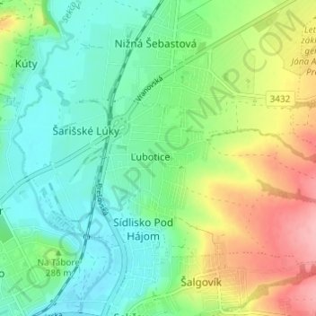
Name: Topografische Karte Ľubotice, Höhe, Relief.
Ort: Ľubotice, Region of Prešov, Eastern Slovakia, 080 06, Slovakia (48.99126 21.25648 49.03126 21.29648)
Durchschnittliche Höhe: 284 m
Minimale Höhe: 240 m
Maximale Höhe: 372 m
The municipality lies at an elevation of 258 metres (846 ft) and covers an area of 8.324 km² (2,045 acres). It had a population of 3025 people in 2009.