
Spenden
Topografische Karte Guntur
Klicken Sie auf die Karte, um die Höhe anzuzeigen.
Spenden
Guntur
Guntur is located at 16°17′N 80°26′E / 16.29°N 80.43°E / 16.29; 80.43. It has an average elevation of 33 m (108 ft) and is situated on the plains. There are few hills in the surrounding suburban areas and Perecherla Reserve Forest on the north west. The city is around 64 km (40 mi) to the west of the Bay of Bengal on the east coast of India. The Krishna delta lies partly in the Guntur district. There are other smaller rivers and channels in the region such as Guntur Channel, Chandravanka, Naagileru, Guntur Branch Canal etc.
Spenden
Über diese Karte
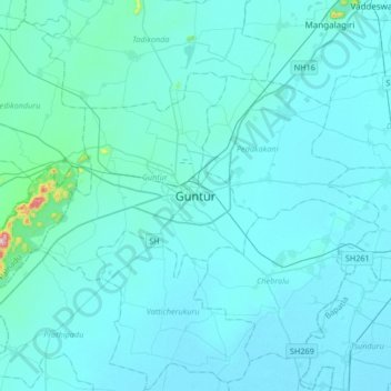
Name: Topografische Karte Guntur, Höhe, Relief.
Ort: Guntur, Andhra Pradesh, 522001, India (16.13152 80.29416 16.45152 80.61416)
Durchschnittliche Höhe: 29 m
Minimale Höhe: 6 m
Maximale Höhe: 474 m
Spenden
Andere topografische Karten
Klicken Sie auf eine Karte, um ihre Topografie, ihre Höhe und ihr Relief anzuzeigen.