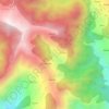
Topografische Karte Prashar Lake
Klicken Sie auf die Karte, um die Höhe anzuzeigen.
Prashar Lake
Parashar Lake (also spelled Prashar Lake) is a freshwater lake located at an elevation of 2,730 metres (8,960 ft) in the Mandi district of Himachal Pradesh, India. It lies 12 km (7.5 mi) north of the town of Mandi, and has a three storied pagoda-like temple dedicated to the sage Parashara situated on its bank. It contains a floating island.
Über diese Karte

Name: Topografische Karte Prashar Lake, Höhe, Relief.
Ort: Prashar Lake, Aut, Mandi, Himachal Pradesh, India (31.75388 77.10011 31.75506 77.10200)
Durchschnittliche Höhe: 2.421 m
Minimale Höhe: 1.753 m
Maximale Höhe: 2.841 m
Andere topografische Karten
Klicken Sie auf eine Karte, um ihre Topografie, ihre Höhe und ihr Relief anzuzeigen.