
Topografische Karte Fort Fordyce Nature Reserve
Interaktive Karte
Klicken Sie auf die Karte, um die Höhe anzuzeigen.
Über diese Karte
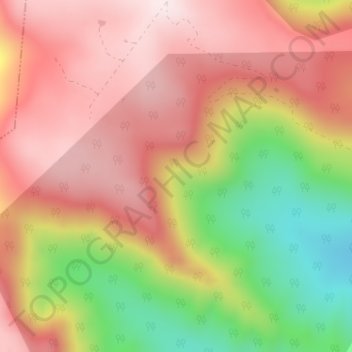
Name: Topografische Karte Fort Fordyce Nature Reserve, Höhe, Relief.
Durchschnittliche Höhe: 963 m
Minimale Höhe: 651 m
Maximale Höhe: 1.176 m
Andere topografische Karten
Klicken Sie auf eine Karte, um ihre Topografie, ihre Höhe und ihr Relief anzuzeigen.
Kat River
RSA > Eastern Cape > Nkonkobe Local Municipality
Kat River, Nkonkobe Local Municipality, Amathole District Municipality, Eastern Cape, RSA
Durchschnittliche Höhe: 362 m
Gaika’s Kop
RSA > Eastern Cape > Nkonkobe Local Municipality
Gaika’s Kop, Nkonkobe Local Municipality, Amathole District Municipality, Eastern Cape, RSA
Durchschnittliche Höhe: 1.583 m