
Spenden
Topografische Karte Milford Haven
Klicken Sie auf die Karte, um die Höhe anzuzeigen.
Spenden
Milford Haven
One of the earliest notable figures from the Milford Haven area is Howell Davis, a pirate born in 1680. He was shot dead in 1719 on the Portuguese island of Príncipe. Other famous residents connected as seafarers include Isaac Davis, a former seaman who was engaged in the fur trade between the Pacific Northwest and China. He became an advisor to Kamehameha I and helped form the Kingdom of Hawaii. Milford Haven has produced, or attracted, several notable artists including Arthur Symons, poet, critic, and an art editor of The Savoy magazine, who was born in the town in 1865, and Charles Norris, topographical artist, and author of A Historical Account of Tenby, who lived in Milford Haven from 1800 to 1810. The novelist Alexander Cordell lived briefly in Milford whilst employed by the Admiralty as a quantity surveyor. Journalist John Evans Woolacott, born in Milford 1861, over the course of his career edited or assistant edited various publications including the Democrat, the Weekly Dispatch, The Economist, The Statesman, the Bombay Gazette and The Pioneer. He was elected as president of the Institute of Journalists in 1908.
Spenden
Über diese Karte
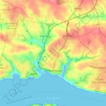
Name: Topografische Karte Milford Haven, Höhe, Relief.
Ort: Milford Haven, Pembrokeshire, Wales, United Kingdom (51.69943 -5.07814 51.74201 -4.99073)
Durchschnittliche Höhe: 36 m
Minimale Höhe: 0 m
Maximale Höhe: 77 m
Spenden
Andere topografische Karten
Klicken Sie auf eine Karte, um ihre Topografie, ihre Höhe und ihr Relief anzuzeigen.