
Vielen Dank für die Unterstützung dieser Website ❤️
Spenden
Spenden
Topografische Karte Dunstable Downs
Klicken Sie auf die Karte, um die Höhe anzuzeigen.
Vielen Dank für die Unterstützung dieser Website ❤️
Spenden
Spenden
Dunstable Downs
Because of its elevation, Dunstable Downs hosted a station in the shutter telegraph chain which connected the Admiralty in London to its naval ships in the port of Great Yarmouth during the years 1808 to 1814.
Vielen Dank für die Unterstützung dieser Website ❤️
Spenden
Spenden
Über diese Karte
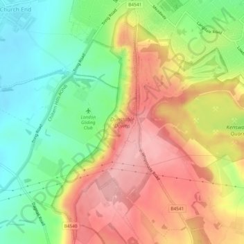
Name: Topografische Karte Dunstable Downs, Höhe, Relief.
Durchschnittliche Höhe: 178 m
Minimale Höhe: 112 m
Maximale Höhe: 245 m
Vielen Dank für die Unterstützung dieser Website ❤️
Spenden
Spenden