
Topografische Karte Pico da Bandeira
Interaktive Karte
Klicken Sie auf die Karte, um die Höhe anzuzeigen.
Über diese Karte
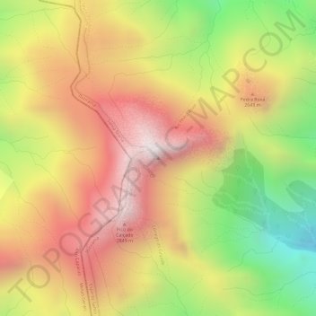
Name: Topografische Karte Pico da Bandeira, Höhe, Relief.
Durchschnittliche Höhe: 2.488 m
Minimale Höhe: 1.976 m
Maximale Höhe: 2.865 m
Pico da Bandeira is also remarkable for being the Brazilian mountain with the greatest topographic isolation: 2,344 km (1,457 miles). This means that at less than that distance, there is no other point on the surface of the Earth at equal or greater elevation. In the Americas, only Aconcagua, Denali, Pico de Orizaba and Mount Whitney are more topographically isolated than Pico da Bandeira, and in the entire world, there are only 20 more isolated mountains.