
Vielen Dank für die Unterstützung dieser Website ❤️
Spenden
Spenden
Topografische Karte São José do Rio Preto
Klicken Sie auf die Karte, um die Höhe anzuzeigen.
Vielen Dank für die Unterstützung dieser Website ❤️
Spenden
Spenden
São José do Rio Preto
São José do Rio Preto is located in northwest of the state of São Paulo in a region between the rivers Grande, Paraná and Tietê. The ecological makeup of the region blends elements of the Cerrado (Brazilian savanna) with remnants of the Atlantic Forest. In terms of topography, the area is characterized by gently rolling terrain, with an average elevation of 489 m (1,604 ft).
Vielen Dank für die Unterstützung dieser Website ❤️
Spenden
Spenden
Über diese Karte
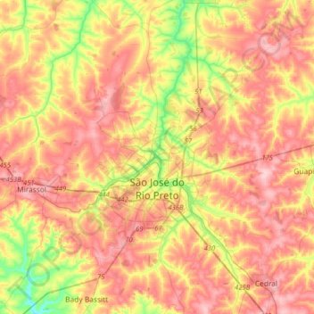
Name: Topografische Karte São José do Rio Preto, Höhe, Relief.
Durchschnittliche Höhe: 527 m
Minimale Höhe: 430 m
Maximale Höhe: 602 m
Vielen Dank für die Unterstützung dieser Website ❤️
Spenden
Spenden