
Topografische Karte Setsoto Ward 11
Interaktive Karte
Klicken Sie auf die Karte, um die Höhe anzuzeigen.
Über diese Karte
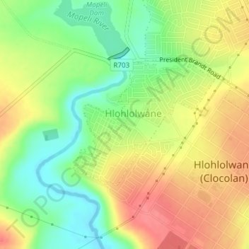
Name: Topografische Karte Setsoto Ward 11, Höhe, Relief.
Durchschnittliche Höhe: 1.574 m
Minimale Höhe: 1.539 m
Maximale Höhe: 1.606 m
Andere topografische Karten
Klicken Sie auf eine Karte, um ihre Topografie, ihre Höhe und ihr Relief anzuzeigen.
Willem Pretorius Wildtuin
RSA > Free State > Setsoto Local Municipality
Willem Pretorius Wildtuin, Setsoto Ward 3, Setsoto Local Municipality, Thabo Mofutsanyana District Municipality, Free State, RSA
Durchschnittliche Höhe: 1.371 m