
Topografische Karte Rosarito
Interaktive Karte
Klicken Sie auf die Karte, um die Höhe anzuzeigen.
Rosarito
Playas de Rosarito lies on the coast of the Pacific Ocean on the North Baja California Peninsula. The city is positioned between the foothills of the Peninsular Ranges and the ocean. It maintains a relatively uniform topography and displays few variances in terrain.
Über diese Karte
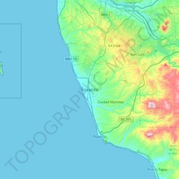
Name: Topografische Karte Rosarito, Höhe, Relief.
Durchschnittliche Höhe: 103 m
Minimale Höhe: 0 m
Maximale Höhe: 724 m