
Spenden
Topografische Karte Belle River
Klicken Sie auf die Karte, um die Höhe anzuzeigen.
Spenden
Über diese Karte
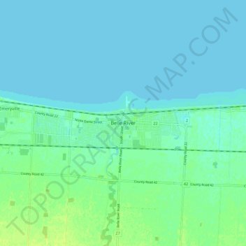
Name: Topografische Karte Belle River, Höhe, Relief.
Durchschnittliche Höhe: 177 m
Minimale Höhe: 173 m
Maximale Höhe: 186 m
Spenden
Andere topografische Karten
Klicken Sie auf eine Karte, um ihre Topografie, ihre Höhe und ihr Relief anzuzeigen.
Spenden
Lakeshore
Canada > Ontario > Essex County
As in the rest of Essex County and Chatham-Kent, the terrain is extremely flat and regular. The terrain slopes very gently from the southern border of Lakeshore on Highway 8, with an average elevation of 188 m (617 ft), to the shore of Lake St. Clair at 176 m (577 ft). The highest land is in the southwestern…
Durchschnittliche Höhe: 183 m
Spenden