
Topografische Karte Roxburgh
Interaktive Karte
Klicken Sie auf die Karte, um die Höhe anzuzeigen.
Über diese Karte
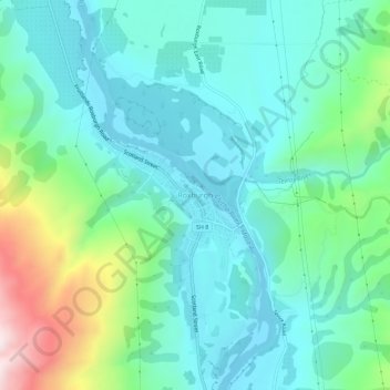
Name: Topografische Karte Roxburgh, Höhe, Relief.
Durchschnittliche Höhe: 223 m
Minimale Höhe: 74 m
Maximale Höhe: 720 m
Andere topografische Karten
Klicken Sie auf eine Karte, um ihre Topografie, ihre Höhe und ihr Relief anzuzeigen.
Shingle Creek
New Zealand > Otago > Central Otago District > Teviot Valley Community
Shingle Creek, Teviot Valley Community, Central Otago District, Otago, New Zealand
Durchschnittliche Höhe: 307 m
Millers Flat
New Zealand > Otago > Central Otago District > Teviot Valley Community
Millers Flat, Teviot Valley Community, Central Otago District, Otago, 9572, New Zealand
Durchschnittliche Höhe: 161 m