
Topografische Karte Alandi
Klicken Sie auf die Karte, um die Höhe anzuzeigen.
Alandi
Alandi (18°40′37.42″N 73°53′47.76″E / 18.6770611°N 73.8966000°E / 18.6770611; 73.8966000) is located on the bank of the Indrayani River, 18.8 km (11.7 mi) from Khed Taluka of Pune District, near the northern edge of the city of Pune. Alandi has an average elevation of 577 meters (1,893 feet).
Über diese Karte
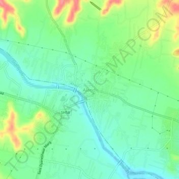
Name: Topografische Karte Alandi, Höhe, Relief.
Ort: Alandi, Khed, Pune District, Maharashtra, 412105, India (18.65724 73.87811 18.69724 73.91811)
Durchschnittliche Höhe: 578 m
Minimale Höhe: 552 m
Maximale Höhe: 631 m
Andere topografische Karten
Klicken Sie auf eine Karte, um ihre Topografie, ihre Höhe und ihr Relief anzuzeigen.