

Topografische Karte Udaipur
Klicken Sie auf die Karte, um die Höhe anzuzeigen.
Udaipur
Udaipur is located at 23°32′N 91°29′E / 23.53°N 91.48°E / 23.53; 91.48. It has an average elevation of 22 meters (72 feet)from the sea level. The Gomati river passes through the heart of Udaipur and helps in irrigation of its lands.
Über diese Karte
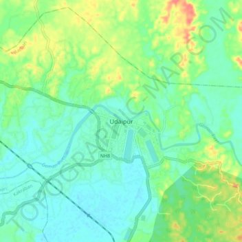
Name: Topografische Karte Udaipur, Höhe, Relief.
Ort: Udaipur, Matarbari, Udaipur, Gomati, Tripura, 799120, India (23.50162 91.45176 23.58162 91.53176)
Durchschnittliche Höhe: 33 m
Minimale Höhe: 16 m
Maximale Höhe: 70 m