
Topografische Karte Arak
Interaktive Karte
Klicken Sie auf die Karte, um die Höhe anzuzeigen.
Arak
Arak is surrounded by mountains in the south, west, and east, and its average altitude is about 1750m above sea level. It is located 260 km from the city of Tehran, and is in the vicinity of the cities of Qom and Isfahan.
Über diese Karte
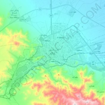
Name: Topografische Karte Arak, Höhe, Relief.
Ort: Arak, بخش مرکزی, Arak County, Markazi Province, Iran (34.04294 49.60821 34.13117 49.79708)
Durchschnittliche Höhe: 1.871 m
Minimale Höhe: 1.669 m
Maximale Höhe: 2.616 m