

Topografische Karte Cañon City
Klicken Sie auf die Karte, um die Höhe anzuzeigen.
Cañon City
The city's nickname, "the Climate Capital of Colorado", derives from the combination of unique geography and 5,300-foot (1,600 m) elevation protecting the city from harsh weather conditions. The average daily high temperature in January is 14 °F (7.8 °C) warmer in Cañon City than in Grand Junction, even though the elevation of Cañon City is higher.
Über diese Karte
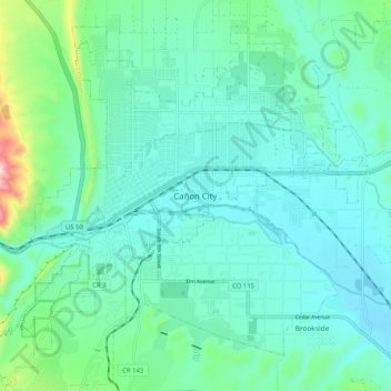
Name: Topografische Karte Cañon City, Höhe, Relief.
Ort: Cañon City, Fremont County, Colorado, 81212, United States (38.40236 -105.26249 38.48236 -105.18249)
Durchschnittliche Höhe: 1.670 m
Minimale Höhe: 1.589 m
Maximale Höhe: 2.045 m