
Topografische Karte Lansdowne
Klicken Sie auf die Karte, um die Höhe anzuzeigen.
Lansdowne
Lansdowne is a quaint hill station in the Pauri Garhwal district of Uttarakhand, India. Lodged in the picturesque surroundings of the Himalayan ranges, it lies at an elevation of approximately 1,700 meters (5,577 feet) above sea level. The town is about 45 kilometers (28 miles) from the district headquarters, Pauri, and approximately 250 kilometers (155 miles) from the state capital, Dehradun
Über diese Karte
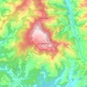
Name: Topografische Karte Lansdowne, Höhe, Relief.
Ort: Lansdowne, Pauri Garhwal, Uttarakhand, 246193, India (29.79784 78.64176 29.87784 78.72176)
Durchschnittliche Höhe: 1.140 m
Minimale Höhe: 686 m
Maximale Höhe: 1.834 m