
Vielen Dank für die Unterstützung dieser Website ❤️
Spenden
Spenden
Topografische Karte Kaycee
Klicken Sie auf die Karte, um die Höhe anzuzeigen.
Vielen Dank für die Unterstützung dieser Website ❤️
Spenden
Spenden
Über diese Karte
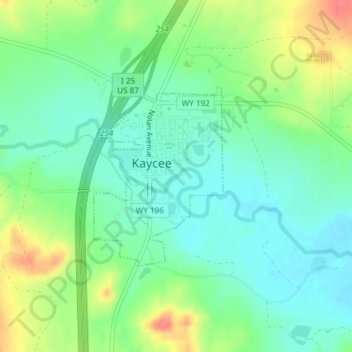
Name: Topografische Karte Kaycee, Höhe, Relief.
Ort: Kaycee, Johnson County, Wyoming, United States (43.70233 -106.64507 43.71606 -106.63127)
Durchschnittliche Höhe: 1.431 m
Minimale Höhe: 1.409 m
Maximale Höhe: 1.473 m
Vielen Dank für die Unterstützung dieser Website ❤️
Spenden
Spenden
Andere topografische Karten
Klicken Sie auf eine Karte, um ihre Topografie, ihre Höhe und ihr Relief anzuzeigen.