
Topografische Karte Mieres
Interaktive Karte
Klicken Sie auf die Karte, um die Höhe anzuzeigen.
Über diese Karte
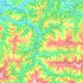
Name: Topografische Karte Mieres, Höhe, Relief.
Ort: Mieres, Asturias, Spain (43.18111 -5.85553 43.28914 -5.62549)
Durchschnittliche Höhe: 498 m
Minimale Höhe: 116 m
Maximale Höhe: 1.171 m
Mieres is the heart of the coal mining industry in Spain. The topography of Mieres is mountainous with the greatest population centers being located in the valley along the banks of the Caudal River (Río Caudal) valley in the center of Asturias. Before the Spanish Industrial Restructuring Mieres was one of the industrial backbones of Asturias, and hosted 70000 inhabitants in the 1960s. Today Mieres shelters a campus of the University of Oviedo and different museums in relation with the industrial heritage.