

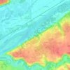
Topografische Karte La Ferrière
Klicken Sie auf die Karte, um die Höhe anzuzeigen.
La Ferrière
La Dême, d'une longueur totale de 32,5 km, prend sa source à 160 m d'altitude à Monthodon et se jette dans le Loir à Vouvray-sur-Loir, à 47 m d'altitude, après avoir traversé 9 communes. Ce cours d'eau est classé dans la liste 2 au titre de l'article L. 214-17 du code de l'environnement sur le Bassin Loire-Bretagne. Du fait de ce classement, tout ouvrage doit être géré, entretenu et équipé selon des règles définies par l'autorité administrative, en concertation avec le propriétaire ou, à défaut, l'exploitant. Sur le plan piscicole, la Dême est classée en première catégorie piscicole. Le groupe biologique dominant est constitué essentiellement de salmonidés (truite, omble chevalier, ombre commun, huchon).
Über diese Karte

Name: Topografische Karte La Ferrière, Höhe, Relief.
Durchschnittliche Höhe: 153 m
Minimale Höhe: 110 m
Maximale Höhe: 173 m
Andere topografische Karten
Klicken Sie auf eine Karte, um ihre Topografie, ihre Höhe und ihr Relief anzuzeigen.
La Ville
France > Centre-Val de Loire > Indre-et-Loire > Chinon > La Ville
Durchschnittliche Höhe: 52 m


Les Hucaudières
France > Centre-Val de Loire > Indre-et-Loire > Villandry
Durchschnittliche Höhe: 60 m

La Fuye de Vaux
France > Centre-Val de Loire > Indre-et-Loire > Sainte-Maure-de-Touraine > La Fuye de Vaux
Durchschnittliche Höhe: 96 m


La Côte Chaude
France > Centre-Val de Loire > Indre-et-Loire > Saint-Règle
Durchschnittliche Höhe: 93 m

La Dragonnière
France > Centre-Val de Loire > Indre-et-Loire > Saint-Épain
Durchschnittliche Höhe: 82 m

La Maison Rouge
France > Centre-Val de Loire > Indre-et-Loire > Villandry
Durchschnittliche Höhe: 63 m


La Petite Rabaudière
France > Centre-Val de Loire > Indre-et-Loire > Bossay-sur-Claise
Durchschnittliche Höhe: 129 m


La Proutière
France > Centre-Val de Loire > Indre-et-Loire > Épeigné-sur-Dême
Durchschnittliche Höhe: 106 m


La Grande Rue
France > Centre-Val de Loire > Indre-et-Loire > Rochecorbon
Durchschnittliche Höhe: 77 m


La Petite Carte
France > Centre-Val de Loire > Indre-et-Loire > Joué-lès-Tours
Durchschnittliche Höhe: 70 m
Les Dandillons
France > Centre-Val de Loire > Indre-et-Loire > Azay-le-Rideau
Durchschnittliche Höhe: 77 m

Chausseloup
France > Centre-Val de Loire > Indre-et-Loire > Chanceaux-sur-Choisille
Durchschnittliche Höhe: 96 m
La Terre de la Ceuille Roulée
France > Centre-Val de Loire > Indre-et-Loire > Langeais
Durchschnittliche Höhe: 89 m
Les Coutures
France > Centre-Val de Loire > Indre-et-Loire > La Ville-aux-Dames
Durchschnittliche Höhe: 57 m

La Foire de Saint-Roch
France > Centre-Val de Loire > Indre-et-Loire > Saint-Roch
Durchschnittliche Höhe: 96 m
Coteau des Verrons
France > Centre-Val de Loire > Indre-et-Loire > Noizay
Durchschnittliche Höhe: 74 m
Saint-Sulpice
France > Centre-Val de Loire > Indre-et-Loire > Chambourg-sur-Indre
Durchschnittliche Höhe: 90 m
Le Buisson
France > Centre-Val de Loire > Indre-et-Loire > Tauxigny-Saint-Bauld
Durchschnittliche Höhe: 97 m
Le Stade
France > Centre-Val de Loire > Indre-et-Loire > Montlouis-sur-Loire
Durchschnittliche Höhe: 59 m
Le Papillon
France > Centre-Val de Loire > Indre-et-Loire > Parçay-Meslay
Durchschnittliche Höhe: 103 m


Nouy
France > Centre-Val de Loire > Indre-et-Loire > Saint-Martin-le-Beau
Durchschnittliche Höhe: 72 m

La Grangette
France > Centre-Val de Loire > Indre-et-Loire > Montlouis-sur-Loire
Durchschnittliche Höhe: 59 m


Île de Porteau
France > Centre-Val de Loire > Indre-et-Loire > La Chapelle-sur-Loire
Durchschnittliche Höhe: 34 m
Les Chauvelles
France > Centre-Val de Loire > Indre-et-Loire > Azay-le-Rideau > Lionnière
Durchschnittliche Höhe: 81 m

Parc du Lac des Bretonnières
France > Centre-Val de Loire > Indre-et-Loire > Joué-lès-Tours > La Petite Carte
Durchschnittliche Höhe: 85 m


Les Prés du Maine
France > Centre-Val de Loire > Indre-et-Loire > Boussay
Durchschnittliche Höhe: 107 m


La Croix
France > Centre-Val de Loire > Indre-et-Loire > Savigny-en-Véron
Durchschnittliche Höhe: 35 m


La Grange du Bois
France > Centre-Val de Loire > Indre-et-Loire > Épeigné-les-Bois
Durchschnittliche Höhe: 105 m

La Tuilerie
France > Centre-Val de Loire > Indre-et-Loire > La Croix-en-Touraine
Durchschnittliche Höhe: 74 m

Château de Villandry
France > Centre-Val de Loire > Indre-et-Loire > Villandry > Le Château
Durchschnittliche Höhe: 64 m

Le Puy Mary
France > Centre-Val de Loire > Indre-et-Loire > Le Petit-Pressigny
Durchschnittliche Höhe: 123 m



La Vallée des Caves
France > Centre-Val de Loire > Indre-et-Loire > Rochecorbon
Durchschnittliche Höhe: 110 m
Le Carroi
France > Centre-Val de Loire > Indre-et-Loire > Mazières-de-Touraine
Durchschnittliche Höhe: 91 m


Étang de la Roche
France > Centre-Val de Loire > Indre-et-Loire > Nouzilly
Durchschnittliche Höhe: 115 m

Les Beauces
France > Centre-Val de Loire > Indre-et-Loire > Notre-Dame-d'Oé
Durchschnittliche Höhe: 99 m

Les Bains
France > Centre-Val de Loire > Indre-et-Loire > Saint-Paterne-Racan
Durchschnittliche Höhe: 97 m
La Canauderie
France > Centre-Val de Loire > Indre-et-Loire > Saint-Avertin
Durchschnittliche Höhe: 82 m



Parc du Val de Loire
France > Centre-Val de Loire > Indre-et-Loire > Montlouis-sur-Loire > Le Bourg
Durchschnittliche Höhe: 63 m
Repos de Saint-Martin
France > Centre-Val de Loire > Indre-et-Loire > Chinon
Durchschnittliche Höhe: 47 m
Les Ansaults
France > Centre-Val de Loire > Indre-et-Loire > Artannes-sur-Indre
Durchschnittliche Höhe: 73 m

Le Sabot Rouge
France > Centre-Val de Loire > Indre-et-Loire > Sainte-Maure-de-Touraine
Durchschnittliche Höhe: 98 m
La Blottière
France > Centre-Val de Loire > Indre-et-Loire > Beaumont-Louestault
Durchschnittliche Höhe: 121 m
Les Availlons
France > Centre-Val de Loire > Indre-et-Loire > Yzeures-sur-Creuse
Durchschnittliche Höhe: 93 m
La Brosse
France > Centre-Val de Loire > Indre-et-Loire > Fondettes > La Brosse
Durchschnittliche Höhe: 94 m
La Petite Bruzette
France > Centre-Val de Loire > Indre-et-Loire > Fondettes
Durchschnittliche Höhe: 85 m

La Haute Rue
France > Centre-Val de Loire > Indre-et-Loire > Beaumont-en-Véron > La Haute Rue
Durchschnittliche Höhe: 40 m


Le Carroi
France > Centre-Val de Loire > Indre-et-Loire > Cinq-Mars-la-Pile
Durchschnittliche Höhe: 80 m


Tréché
France > Centre-Val de Loire > Indre-et-Loire > Fondettes > Tréché
Durchschnittliche Höhe: 90 m


La Simaudière
France > Centre-Val de Loire > Indre-et-Loire > Sorigny > La Simaudière
Durchschnittliche Höhe: 99 m

La Grand’ Vallée
France > Centre-Val de Loire > Indre-et-Loire > Villedômer > La Grand’ Vallée
Durchschnittliche Höhe: 120 m


Les Regains
France > Centre-Val de Loire > Indre-et-Loire > Nazelles-Négron
Durchschnittliche Höhe: 76 m

La Mulotière
France > Centre-Val de Loire > Indre-et-Loire > Langeais > La Mulotière
Durchschnittliche Höhe: 62 m

Les Sablons
France > Centre-Val de Loire > Indre-et-Loire > Cléré-les-Pins > Les Sablons
Durchschnittliche Höhe: 99 m

Le Couvent
France > Centre-Val de Loire > Indre-et-Loire > Sainte-Maure-de-Touraine > Le Couvent
Durchschnittliche Höhe: 97 m

Le Chardonneret
France > Centre-Val de Loire > Indre-et-Loire > Nouzilly > Le Chardonneret
Durchschnittliche Höhe: 132 m


La Folie
France > Centre-Val de Loire > Indre-et-Loire > Château-Renault > La Folie
Durchschnittliche Höhe: 115 m