Geolokalisieren
👉 Easily get elevation data in JSON, GeoTIFF and KML formats using Elevation API
Vielen Dank für die Unterstützung dieser Website ❤️
Spenden

Topografische Karte Valencia

Klicken Sie auf die Karte, um die Höhe anzuzeigen.

👉 Easily get elevation data in JSON, GeoTIFF and KML formats using Elevation API
Vielen Dank für die Unterstützung dieser Website ❤️
Spenden

Über diese Karte

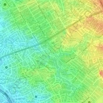
Name: Topografische Karte Valencia, Höhe, Relief.

Ort: Valencia, 4th District, Quezon City, Eastern Manila District, Metro Manila, 1100, Philippines (14.60631 121.03126 14.61511 121.04213)

Durchschnittliche Höhe: 25 m

Minimale Höhe: 4 m

Maximale Höhe: 48 m

👉 Easily get elevation data in JSON, GeoTIFF and KML formats using Elevation API
Vielen Dank für die Unterstützung dieser Website ❤️
Spenden

Andere topografische Karten

Klicken Sie auf eine Karte, um ihre Topografie, ihre Höhe und ihr Relief anzuzeigen.

La Mesa Eco Park

Philippines > Quezon City

Covering an area of 33 hectares (82 acres) the public park is located along the natural boundary of the La Mesa Watershed Reservation and its elevation is about 40 metres (130 ft) below than the resorvoir.

Durchschnittliche Höhe: 66 m

Quezon City

Philippines > Quezon City

Founded as a pueblo by Saint Pedro Bautista in 1590, San Francisco del Monte may be considered Quezon City's oldest district. The original land area of the old town of San Francisco del Monte was approximately2.5 square kilometres (1.0 sq mi) and covered parts of what is currently known as Project 7 and 8 and…

Durchschnittliche Höhe: 57 m

Tullahan River

Philippines > Quezon City

Durchschnittliche Höhe: 50 m

Parkside 1

Philippines > Quezon City

Durchschnittliche Höhe: 22 m

Vielen Dank für die Unterstützung dieser Website ❤️
Spenden

Barangay Mariana Park

Philippines > Quezon City

Durchschnittliche Höhe: 23 m

Lagarian Creek

Philippines > Quezon City

Durchschnittliche Höhe: 54 m

Vielen Dank für die Unterstützung dieser Website ❤️
Spenden