
Topografische Karte Camberwell
Interaktive Karte
Klicken Sie auf die Karte, um die Höhe anzuzeigen.
Über diese Karte
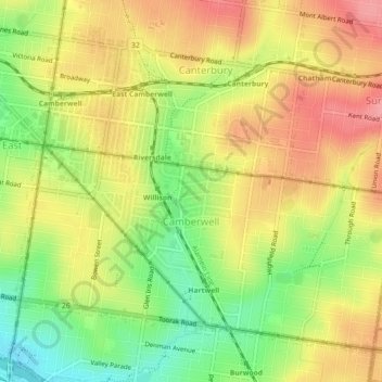
Name: Topografische Karte Camberwell, Höhe, Relief.
Durchschnittliche Höhe: 66 m
Minimale Höhe: 14 m
Maximale Höhe: 109 m
The Prospect Hill Road Precinct area is adjacent to the railway station and is the oldest part of the suburb. The original subdivision was relatively generous blocks, which were quickly filled with fine Victorian and Edwardian houses. Due to its hilly topography, many east–west streets in the Prospect Hill area have an excellent view of Melbourne's Central Business District. Its main commercial centre developed along Burke Road from its railway station to Camberwell Junction, 500 m to the south. Several tram routes converge on this point.