Geolokalisieren

Topografische Karte Tabusintac River

Interaktive Karte

Klicken Sie auf die Karte, um die Höhe anzuzeigen.

Über diese Karte

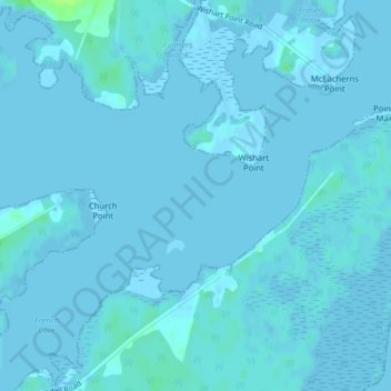
Name: Topografische Karte Tabusintac River, Höhe, Relief.

Ort: Tabusintac River, Northumberland County, New Brunswick, Canada (47.33237 -64.98171 47.33247 -64.98161)

Durchschnittliche Höhe: 1 m

Minimale Höhe: -3 m

Maximale Höhe: 10 m

Andere topografische Karten

Klicken Sie auf eine Karte, um ihre Topografie, ihre Höhe und ihr Relief anzuzeigen.

Glenwood

Canada > New Brunswick > Northumberland County

Glenwood, Glenelg Parish, Northumberland County, New Brunswick, Canada

Durchschnittliche Höhe: 39 m

Pineville

Canada > New Brunswick > Northumberland County

Pineville, Blackville Parish, Northumberland County, New Brunswick, Canada

Durchschnittliche Höhe: 38 m

Pleasant Ridge

Canada > New Brunswick > Northumberland County

Pleasant Ridge, Rogersville Parish, Northumberland County, New Brunswick, E4Y 2N2, Canada

Durchschnittliche Höhe: 89 m

Tilley Ridge

Canada > New Brunswick > Northumberland County

Tilley Ridge, Northesk Parish, Northumberland County, New Brunswick, Canada

Durchschnittliche Höhe: 591 m

Black Point

Canada > New Brunswick > Northumberland County

Black Point, Alnwick Parish, Northumberland County, New Brunswick, Canada

Durchschnittliche Höhe: 1 m

Priceville

Canada > New Brunswick > Northumberland County

Priceville, Ludlow Parish, Northumberland County, New Brunswick, Canada

Durchschnittliche Höhe: 99 m