Geolokalisieren

Topografische Karte 天路十八弯

Interaktive Karte

Klicken Sie auf die Karte, um die Höhe anzuzeigen.

Über diese Karte

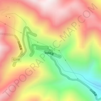
Name: Topografische Karte 天路十八弯, Höhe, Relief.

Ort: 天路十八弯, 雅江县, 甘孜藏族自治州, 四川省, 627400, 中国 (29.98841 100.87001 30.00841 100.89001)

Durchschnittliche Höhe: 4.165 m

Minimale Höhe: 3.680 m

Maximale Höhe: 4.559 m

Andere topografische Karten

Klicken Sie auf eine Karte, um ihre Topografie, ihre Höhe und ihr Relief anzuzeigen.

红龙镇

中国 > 四川省 > 雅江县

红龙镇, 雅江县, 甘孜藏族自治州, 四川省, 627400, 中国

Durchschnittliche Höhe: 4.297 m

西俄洛镇

中国 > 四川省 > 雅江县

西俄洛镇, 雅江县, 甘孜藏族自治州, 四川省, 627400, 中国

Durchschnittliche Höhe: 3.855 m

麻郎错乡

中国 > 四川省 > 雅江县

麻郎错乡, 雅江县, 甘孜藏族自治州, 四川省, 中国

Durchschnittliche Höhe: 3.274 m

米龙乡

中国 > 四川省 > 雅江县

米龙乡, 雅江县, 甘孜藏族自治州, 四川省, 中国

Durchschnittliche Höhe: 3.246 m

雅江县

中国 > 四川省 > 雅江县

雅江县, 甘孜藏族自治州, 四川省, 627400, 中国

Durchschnittliche Höhe: 3.651 m

热嘎

中国 > 四川省 > 雅江县 > 热嘎

热嘎, 雅江县, 甘孜藏族自治州, 四川省, 中国

Durchschnittliche Höhe: 2.937 m