
Topografische Karte Lupao
Klicken Sie auf die Karte, um die Höhe anzuzeigen.
Lupao
Lupao belongs to the first type of climate in the Philippines. This type of climate has two (2) pronounced seasons: dry from the month of November to April and Wet during the rest of the year. This type of climate is typically hot, humid and tropical and is generally affected by the neighboring topography and the prevalent wind direction that varies within the year.
Über diese Karte
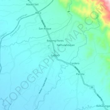
Name: Topografische Karte Lupao, Höhe, Relief.
Ort: Lupao, Nueva Ecija, Central Luzon, Philippines (15.83701 120.85952 15.91701 120.93952)
Durchschnittliche Höhe: 163 m
Minimale Höhe: 89 m
Maximale Höhe: 788 m