
Topografische Karte Aizawl
Klicken Sie auf die Karte, um die Höhe anzuzeigen.
Aizawl
Aizawl (English: /aɪˈzɔːl/; Mizo: [ˈaɪ̯.ˈzɔːl] ), formerly known as Aijal, is the capital city and the most populous city of Mizoram, India. It is also the third largest city in northeast India, after Guwahati and Agartala. It is situated atop a series of ridges, with an average elevation of around 1,132 metres (3,714 feet) above sea level. In 2024, the city has an estimated population of 405,000 people.
Über diese Karte
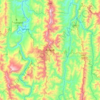
Name: Topografische Karte Aizawl, Höhe, Relief.
Ort: Aizawl, Tlangnuam, Aizawl, Mizoram, 796190, India (23.56776 92.55799 23.88776 92.87799)
Durchschnittliche Höhe: 562 m
Minimale Höhe: 61 m
Maximale Höhe: 1.515 m