
Topografische Karte Salur
Interaktive Karte
Klicken Sie auf die Karte, um die Höhe anzuzeigen.
Über diese Karte
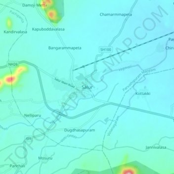
Name: Topografische Karte Salur, Höhe, Relief.
Ort: Salur, Parvathipuram Manyam, Andhra Pradesh, 532591, India (18.47770 83.16810 18.55770 83.24810)
Durchschnittliche Höhe: 163 m
Minimale Höhe: 132 m
Maximale Höhe: 480 m
Salur is on the banks of River Vegavathi at 18°32′00″N 83°13′00″E / 18.5333°N 83.2167°E / 18.5333; 83.2167. It has an average elevation of 118 metres (387 ft). It is bounded by Makkuva, Bobbili, Ramabhadrapuram and Pachipenta mandals of Andhra Pradesh state. Salur is surrounded with green forests and chains of hills on two sides and by River Vegavathi on the other two.