Geolokalisieren

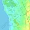
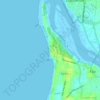
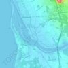
Topografische Karte Praia de Ofir

Klicken Sie auf die Karte, um die Höhe anzuzeigen.

Über diese Karte

Name: Topografische Karte Praia de Ofir, Höhe, Relief.

Ort: Praia de Ofir, Ofir, Apúlia e Fão, Esposende, Braga, Portugal (41.51566 -8.78881 41.52107 -8.78680)

Durchschnittliche Höhe: 2 m

Minimale Höhe: -4 m

Maximale Höhe: 14 m

Andere topografische Karten

Klicken Sie auf eine Karte, um ihre Topografie, ihre Höhe und ihr Relief anzuzeigen.

Maceira

Portugal > Braga > Esposende

Durchschnittliche Höhe: 184 m

Miradouro do Monte de Faro

Portugal > Braga > Esposende

Durchschnittliche Höhe: 67 m

São Paio de Cima

Portugal > Braga > Esposende > Antas

Durchschnittliche Höhe: 113 m

Apúlia

Portugal > Braga > Esposende

Durchschnittliche Höhe: 10 m

Parque Natural do Litoral Norte

Portugal > Braga > Esposende

Durchschnittliche Höhe: 22 m

Praia das Pedrinhas

Portugal > Braga > Esposende

Durchschnittliche Höhe: 4 m

Praia Suave Mar (Norte)

Portugal > Braga > Esposende

Durchschnittliche Höhe: 5 m

Praia de Ofir

Portugal > Braga > Esposende

Durchschnittliche Höhe: 2 m

Palmeira de Faro

Portugal > Braga > Esposende

Durchschnittliche Höhe: 72 m

Antas

Portugal > Braga > Esposende

Durchschnittliche Höhe: 87 m

Gemeses

Portugal > Braga > Esposende

Durchschnittliche Höhe: 32 m

Forjães

Portugal > Braga > Esposende

Durchschnittliche Höhe: 85 m

Marinhas

Portugal > Braga > Esposende

Durchschnittliche Höhe: 39 m

Fão

Portugal > Braga > Esposende

Durchschnittliche Höhe: 10 m

Pinhote

Portugal > Braga > Esposende

Durchschnittliche Höhe: 63 m

Marinhas

Portugal > Braga > Esposende

Durchschnittliche Höhe: 50 m