Topografische Karte Es Cots
Klicken Sie auf die Karte, um die Höhe anzuzeigen.
Über diese Karte
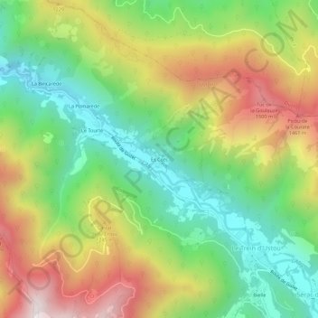
Name: Topografische Karte Es Cots, Höhe, Relief.
Durchschnittliche Höhe: 1.033 m
Minimale Höhe: 600 m
Maximale Höhe: 1.635 m

Klicken Sie auf die Karte, um die Höhe anzuzeigen.
Name: Topografische Karte Es Cots, Höhe, Relief.
Durchschnittliche Höhe: 1.033 m
Minimale Höhe: 600 m
Maximale Höhe: 1.635 m